How Do You Ensure Crews Find the Exact Grave Every Time?
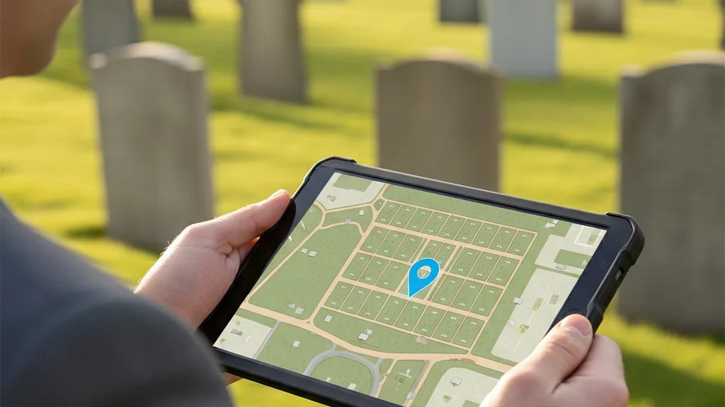
The most reliable way to ensure your grave digging and monument setting crews find the correct location is by using cemetery GPS mapping. This process involves assigning precise geographic coordinates to each space and providing crews with a simple way to navigate to them using a smartphone or tablet. Moving beyond paper maps and physical markers eliminates costly errors, saves staff time, and protects the cemetery from the significant liability of a wrongful interment.
A precise location system isn't a luxury; it's a core part of modern cemetery operations. By creating a definitive digital map and a straightforward workflow, you give your grounds crew the confidence that they are in the right place, every single time. This guide walks through the practical steps of implementing a GPS-guided workflow for your field teams.
The High Cost of 'Close Enough' in Cemetery Operations
Relying on traditional methods for locating graves—like pacing off distances from a tree or counting rows from a landmark—is fraught with risk. A simple miscalculation, a faded flag, or a new employee's unfamiliarity with the grounds can lead to a cascade of expensive and distressing problems. A wrongful interment is one of the most serious errors a cemetery can make, causing immense emotional pain for families and creating significant legal and financial liability for the organization. The cost to disinter and re-inter a burial can be substantial, not to mention the irreparable damage to the cemetery's reputation.
Even when the error isn't a full burial in the wrong plot, mistakes are costly. Monument foundations poured in the wrong spot must be removed and re-poured, doubling labor and material costs. A grave opened just a few feet off-center can encroach on an adjacent space, violating its boundaries and creating a difficult situation that may require complex legal resolutions. These seemingly small errors erode efficiency, drain budgets, and add unnecessary stress to your staff and the families you serve. A system of precision is a fundamental requirement for risk management.
What Is Cemetery GPS Mapping?
Cemetery GPS mapping is the process of creating a precise digital map of your grounds by assigning a unique set of geographic coordinates (latitude and longitude) to every individual space, such as a grave, niche, or crypt. Instead of relying on a section name and a plot number, a space is identified by its exact point on the earth. This digital location data becomes the single source of truth, accessible to both office staff and grounds crews.

Once this data is captured and stored in your cemetery management system, it enables a simple and powerful workflow. When a burial or monument installation is scheduled, the office staff provides the GPS coordinates for the specific space. The grounds crew can then input these coordinates into a standard mapping application on a smartphone or tablet. The app provides turn-by-turn directions to the precise location, eliminating guesswork and the potential for human error. This is the same technology people use every day to find a new restaurant or navigate to a friend's house, applied to the specific needs of cemetery operations.
How to Implement a GPS Workflow for Your Crews
Implementing a GPS-guided workflow involves three main phases: capturing the coordinate data, making it accessible to your team, and training them on the new process. While it requires an initial investment of time, the long-term gains in accuracy and efficiency are significant.
1. Capture Accurate GPS Coordinates for Every Space
The foundation of this system is having accurate data. You can capture coordinates using a dedicated GPS receiver for sub-meter accuracy or, in many cases, a modern smartphone or tablet with a specialized app. The goal is to stand at the center of each space, record the latitude and longitude, and associate it with the correct space ID (e.g., Section C, Lot 12, Space 4). This can be done systematically, section by section, during a comprehensive mapping project. While this project can be done in-house, some cemeteries hire a professional surveying or GIS (Geographic Information System) firm to ensure the highest degree of accuracy, especially for large or complex grounds.
2. Centralize the Data in Your Cemetery Software
Once you have the coordinates, they need to live in a central, accessible place. Storing them in a spreadsheet is a start, but the real power comes from integrating them into your primary cemetery management software. In Sunset, for example, each space record can hold this location data alongside all other critical information like ownership, interment history, and marker details. When everything is in one system, your office staff can pull up a space record and instantly have the exact coordinates needed for a work order. This prevents data silos and ensures everyone is working from the same information.
3. Create a Standard Operating Procedure (SOP) for Field Work
With the data captured and centralized, the final step is to define and train your team on the workflow. A typical SOP looks like this:
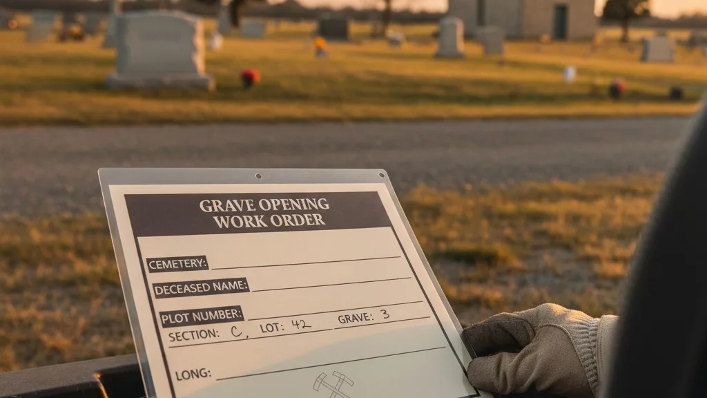
- Work Order Generation: The office generates a work order for a burial or monument setting. This order must include the full space identifier and its precise GPS coordinates, copied directly from the cemetery software.
- Field Navigation: The crew leader receives the work order. They enter the coordinates into a mapping app (like Google Maps or Apple Maps) on a company-provided smartphone or tablet. The app guides them directly to the space.
- On-Site Verification: Upon arrival, the crew performs a final verification. They should still check for the physical plot marker or headstone if one exists and confirm the location against any nearby landmarks noted in the work order. The GPS gets them to the spot; a final visual check confirms it.
- Completion Confirmation: After the work is complete, the crew leader can confirm the task was finished at the correct location, sometimes even using their device to take a photo of the completed work, which can be attached to the record back in the office.
This simple, repeatable process reduces ambiguity and empowers every crew member, new or experienced, to work with confidence and precision.
What are the pitfalls to avoid?
When adopting a GPS workflow, be mindful of a few common challenges. First, ensure you have a plan for areas with poor satellite reception, such as under dense tree canopies or near tall structures. High-quality GPS receivers often perform better in these conditions than standard smartphones. Second, data entry errors are a significant risk; a single transposed digit in a coordinate can send a crew to the wrong side of the cemetery. Always double-check coordinates when they are first recorded and when they are added to work orders. Finally, technology is not a complete substitute for experience. Encourage crews to use GPS as their primary guide but to also engage their knowledge of the grounds for a final common-sense check before breaking ground.
Frequently Asked Questions
What kind of equipment do my crews need?
For most cemeteries, a modern, ruggedized smartphone or tablet is sufficient. These devices have reliable GPS chips and can run standard mapping applications. For cemeteries requiring sub-meter accuracy or those with challenging reception, a dedicated handheld GPS unit from a surveying equipment manufacturer may be a better investment.
Do we need to map the entire cemetery at once?
No, you can implement cemetery GPS mapping in phases. You could start by mapping only your active, unsold inventory, so all new burials and monument work use the system. From there, you can gradually map older sections as time and resources permit. Prioritizing this way allows you to see the benefits quickly without the overhead of a massive upfront project.
Can we use GPS to help families find graves?
Yes, this is a powerful benefit of having GPS data for every space. Once your data is organized, you can use cemetery software like Sunset to enable a public-facing map on your website. This allows families to look up a loved one and get the exact coordinates, which they can use on their own phones to navigate to the gravesite. It's a valuable service that improves the visitor experience.
How accurate does the GPS data need to be?
For grave digging and monument setting, an accuracy of one meter (about three feet) is generally sufficient to get a crew to the correct space, where they can perform a final visual confirmation. Standard mobile devices can often achieve this in open areas. If your spaces are extremely small or tightly packed, you may need to invest in higher-grade equipment to achieve sub-meter or even centimeter-level accuracy.
Better Data Leads to Better Work
Implementing cemetery GPS mapping is more than a technical upgrade; it's a fundamental improvement to your operational integrity. By giving your grounds crews the precise data they need, you eliminate the costly and distressing errors that come from guesswork. You create a safer, more efficient, and more professional operation from the office to the field.
This single source of truth for location data, managed within a central system, becomes an asset that serves your staff and the public for decades. To see how Sunset helps cemeteries organize their space, ownership, and location data in one place, we invite you to book a conversation with our team.